

Water, Falling is a pun that appeals to architects… Here are couple of old waterfall photos from my archives.
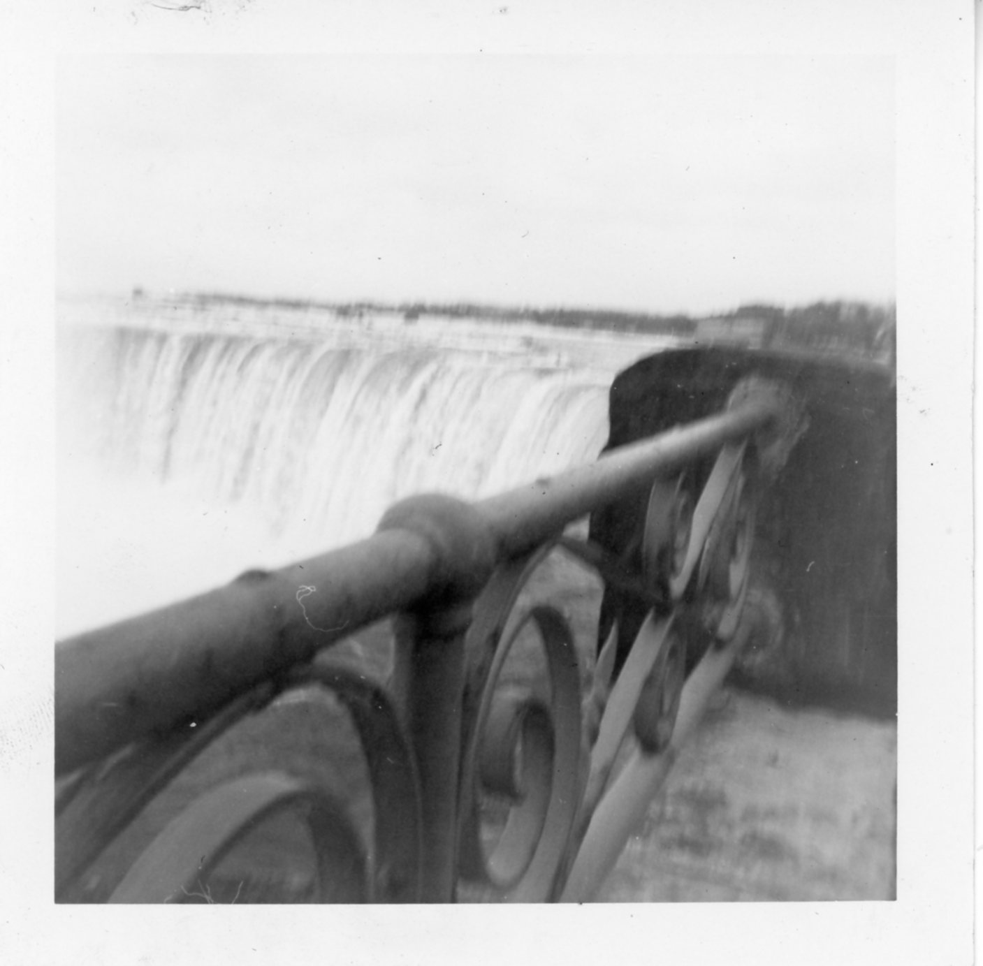
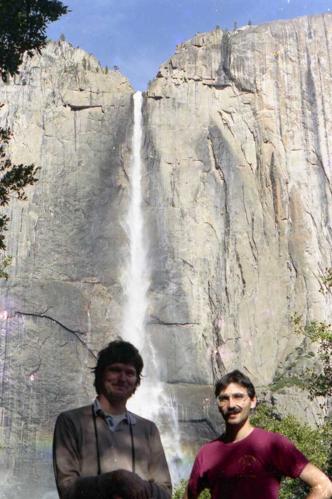
Water, Falling is a pun that appeals to architects… Here are couple of old waterfall photos from my archives.
Filed under Great Hikes, Painting, Poetry, Typecasting, Uncategorized
Painted a couple of days ago – acrylic on 16″ x 12″ canvas board. I have a vague memory of my father painting this same scene 50 years ago. I guess he thought it was picturesque, too.


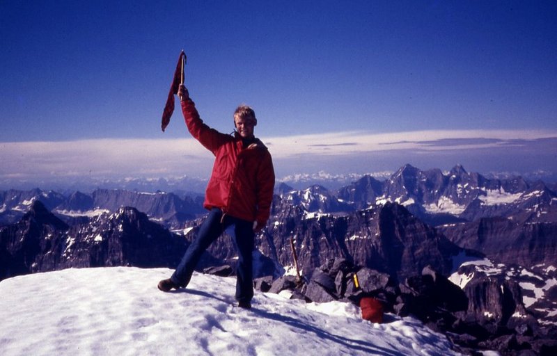
We scramble up to the top of Mt Temple and wrote our names on a slip of paper that we found inside a small metal box jammed under a rock. I took a few pictures and we left in a hurry as there was a big dark cloud coming our way.
Filed under Great Hikes, Painting, Photography, Travel, Typecasting, Uncategorized

Filed under Great Hikes, Poetry, Sketching, Typecasting, Uncategorized
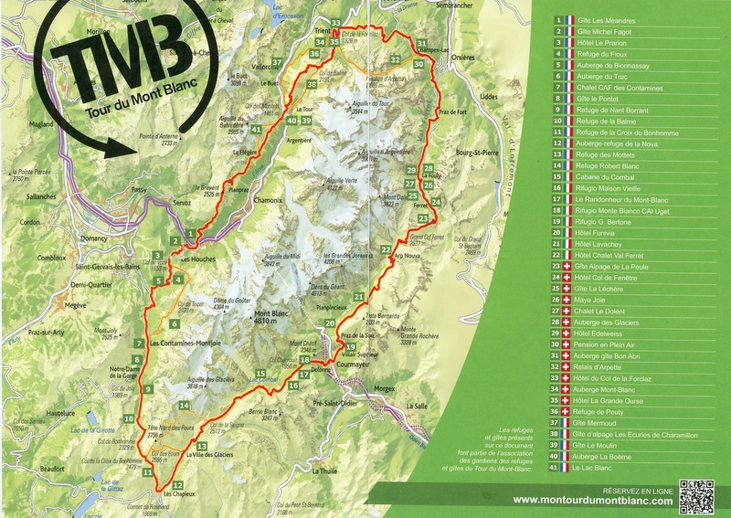
Three years ago I started training to hike the Tour du Mont Blanc, aka the TMB. Every year since then I get nostalgic about that and start hoping that I will get the chance to return to the Alps and wander about from refuge to refuge. So far that hasn’t happened. This past year has been a write off for the world of course, so there was no hope to go to Europe let alone sleep in a refuge full of people who might have Covid 19. This summer it might be possible, if I could get up the nerve to go. However, someone will be doing the TMB and I hope they have a great time. If anyone is interested I wrote a book about my hike, which I have announced here before and am going to do so again, because I added a page to the blog called Tour du Mont Blanc, where I have posted a slice of the book to give you an better idea of what it is about. It’s under the heading above called Tour du Mont Blanc.

Filed under Books, Great Hikes, Tour du Mont Blanc, Travel, Uncategorized
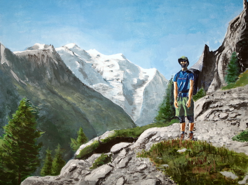
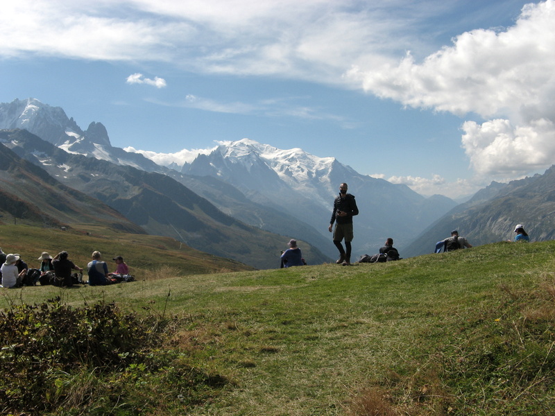
Just finished this one. Hiking season in the Alps should be open now, but with Covid 19 still about, I wonder how the refuges will be affected? This is on the climb from Tre-le-Champ up to the trail called Le Grand Balcon on the opposite side of the Chamonix Valley from Mont Blanc, that big white hulk in the centre background. Most hikers end the Tour de Mont Blanc with this hike, which on a good day affords the best possible view of the great mountain, from a trail that is. This was the last day of our 11 day trek, and I finally convinced Terry to wear the camo boonie hat I had given him.
To get the whole story, you can buy my book A Walk Around Mont Blanc.
Filed under Great Hikes, Painting, Tour du Mont Blanc, Travel, Uncategorized

Exactly one year after I started the walk, the book is published. We began September 1st 2018, and on September 2nd we hung around in the lovely village of Les Contamines, since we goofed up and started a day early. I did not plan that, but it was amusing to write about. I had planned to write about the trip before I went, so I took 2 notebooks and filled them with my observations and thoughts along the way, as well as filling an entire sketchbook journal before I left. There are lots of guidebooks about the Tour de Mont Blanc, and blogs of course, but few paperbacks. My research only came up with one book about hiking the TMB that was not a guidebook. Now there are at least two books on the subject (in English that is). The price is $19.95 (USD). Black and white would have been much cheaper, but in looking at a draft I realized that much of the enjoyment would be lost without the colour photos. So, if you don’t want to spend that much, the E-book is only $2.99!
Filed under Books, Great Hikes
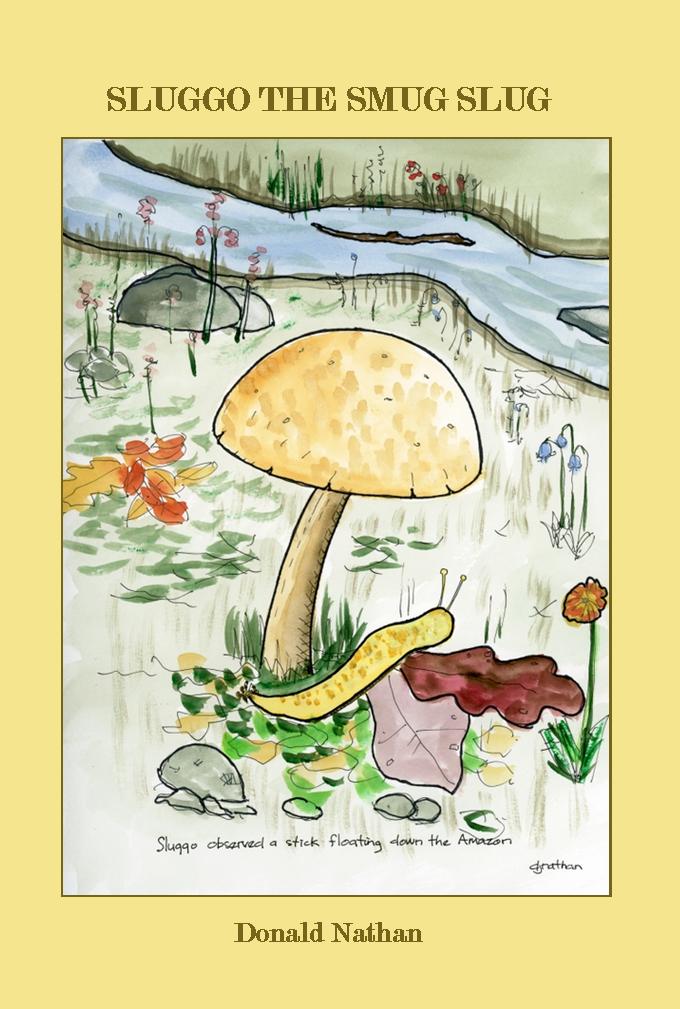
I am pleased to announce that Sluggo the Smug Slug is now available. Click the picture to see the listing. I was originally going to append this story to my upcoming book A Walk Around Mont Blanc, but I decided to keep those books separate entities after all. I am publishing both books in colour, in order to fully appreciate the illustrations and photographs, which black and white printing could not do justice to.
Exactly one year ago today I flew to Germany to hike the Tour de Mont Blanc with my son, Terry. While on the trail in Switzerland, we passed a series of carvings made from tree trunks. This excerpt from A Walk Around Mont Blanc explains where the whole Sluggo thing started:
All day long we walked through woods along easy trails not far above the valley. Sometimes the trail went down to the road or followed a dirt track. We met several guided tours, both British. Usually we stopped and allowed groups to pass us, but this day we actually had to pass them, a rare event. We encountered several interesting physical features where the trail followed a narrow ridge in a straight line, with steep banks on each side that dropped far down into the forest below. They looked like manmade dykes, but otherwise appeared to be natural.

We soon encountered a series of signs indicating we were on a ‘mushroom trail’, and apparently as well, a carved stump trail. Some talented wood carver had sculpted a series of lifelike animals from tree stumps. The first was a deer, followed by a squirrel, marmot, eagle, giant rabbit, wild boar and something we could only think of as a slug, although it was standing up and seemed to have arms. We named this Sluggo the Smug Slug. Following Sluggo we came upon a snail, which we named Aaron the Arrogant Escargot, Sluggo’s best friend. Terry suggested this should be the basis of my next book.

I recorded the day in my journal, and we continued on. I knew that I was going to write about the Tour, but I had no idea that afterwards I would write a book about a slug. After I had written it, I decided to illustrate it too, so I painted many watercolor sketches spawning yet another project – three picture books for toddlers. I therefore take this opportunity to remind you of the first book in the series, which can be found here:

Filed under Books, Great Hikes, Uncategorized
Mt. Blanc from the Col de Balme
Back in May when my son asked me to go with him to hike the TMB I immediately agreed. I had no idea how difficult it would be, but I had a pretty good idea this might be the best shot I’d ever get at doing such a trip. Once I said yes it was too late to back out, something I knew would be a great disappointment to the both of us.
Italy somewhere
As soon as I read about it I knew that I would have to train hard. Luckily there are some trails right outside my door – one that goes around the lake, and another that goes up over a small hill. One go round is about 5.5 kms, and involves about 100 meters of climbing. The other hikes I had at my disposal were a slightly higher hill of about 200 meters, and another lake walk with a few minor hills, totaling about 5.8 kms.
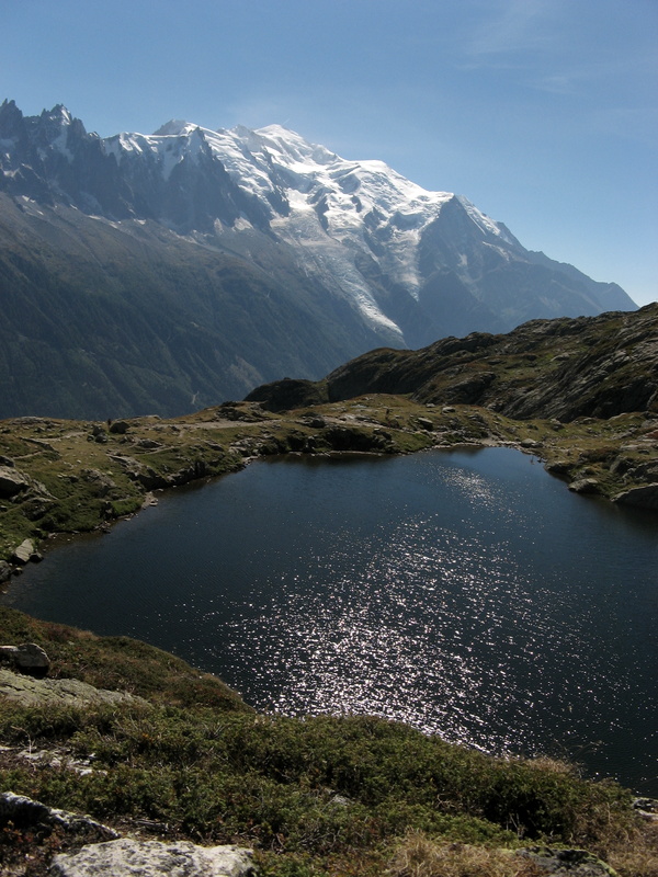
alpine tarn and Mt. Blanc
First I needed boots. With extra wide feet, there aren’t many boots I find comfortable, but I discovered New Balance made boots in 4E, so I bought a pair of those, model 978. Although they were a little light for the very rocky bits, they worked well and I didn’t have any serious complaints, or any blisters, despite the fact that I defied convention by wearing thin socks.
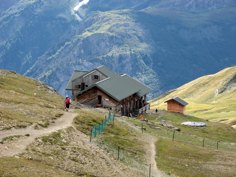
a refuge or auberge
As for a pack, I checked out all the well known brands and found them very expensive. By chance I found a shop with some old stock of internal frame Kelty packs on sale at half the cost of most other packs. I bought a Redwing 50, and it performed beautifully. I liked the fact that this pack had lots of zippers and pockets to keep gear handy when needed. My son’s bag was merely one large sack that he had to dig into every time he needed something from within. The Kelty has one single curved back stay that carries the load down to the excellent waist belt, which cinches very tightly due to compound leverage.
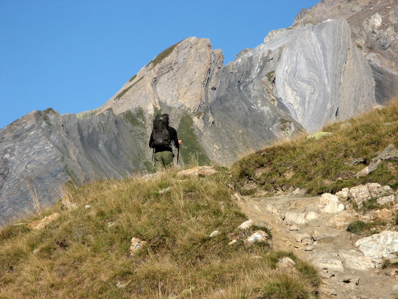
on the trail
Once I got my essential gear in order, with new boots and a new pack, I set out on regular walks with weight in the pack. To start I had 10 pounds, then I increased it to 20 once I gathered my gear and determined I’d have about 18 – 20 lbs. With my pack and boots I began training as often as I could. The first problem was the heat, which this past summer hit 28C fairly often. This is very hot for these parts, and although it’s not so bad for normal living, 28 is a mite warm for strenuous exercise. Nevertheless, it had to be done, so I was out in the heat hiking away the miles, and sweating profusely. This also proved a problem for me feet mostly, which were very hot. That is why in the end I settled on thin socks.
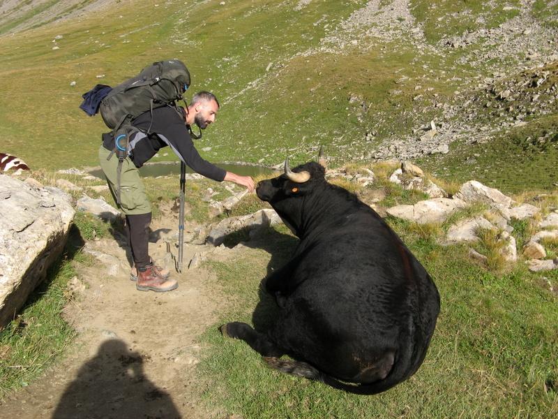
making friends with a cow
I also began a journal of my daily training hikes, using a Strathmore notebook with heavy cotton paper pages suitable for watercolours. For practice I did a few, but mostly I recorded my mileage and observations of how I felt. There were many entries about how tired my legs were, and how wet my shirt was. Some days I had to keep myself soaked down with a wet kerchief to keep from overheating. I became quite attached to my boonie hat too, a US army surplus item that fulfilled every requirement for a warm weather sun hat admirably. Tested in Vietnam, so no surprise it works well in heat. The brim is just the right size, and it can be flipped down or up to suit the sun. I should perhaps have been more patriotic and worn a Canadian Tilley hat, but I feel they make me look like an old fogey, and besides which they aren’t any better than the boonie, and somewhat heavier and harder to stow when not in use.
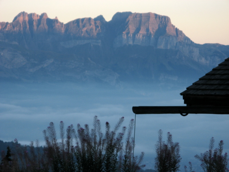
misty evening
After the whole thing was over I tabulated my training and found that I had walked for 86 hours and 274 kms. That’s 1.6 times the length of the TMB, not exactly a lot, but in my case certainly better than nothing, as I am now convinced that without that I would have been done in after the first day or two. On the other hand, my son who is 36 and super strong, did zero preparation and of course was way out in front of me when he wasn’t behind, ready to catch me when I tripped. What 30 years can do to you, it’s terrible! No complaints however, as I got through it on my own steam and no worse for wear.

a bridge in Switzerland
As for my best intentions of watercolour sketches, all I have to show are some pre-trip sketches, one solitary sketch from the hike, and a few done before and after. Fortunately I did keep a daily journal, so I have that and a lot of photographs as a record. Now that it’s over I wish I had it to do again! No matter how much you can recall from writing or pictures, nothing can compare to the joy of walking through a beautiful landscape, no matter how difficult it feels at the time.

one step at a time; 20,000+ a day
Some watercolours from France and Germany:


And some from my pre-trip journal:


Filed under Great Hikes, Photography, Sketching, Tour du Mont Blanc, Travel
a place mat from one of the refuges
Those who have set foot on the trail that circumnavigates Mont Blanc – the TMB – will no doubt recognize the name of the otherwise obscure village of Les Houches, France, where the vast majority of TMB hikers begin their journey. We heard it mentioned most every day when we talked to fellow TMB hikers. There is a very excellent shop there by the way, across from the Bellevue cable car station, where you would be well advised to buy some cheese, bread and a few sausages to carry in your bag. You will need them for energy, I can guarantee it!
The TMB is the most famous hike in the Alps, and thousands do the circuit yearly. It is next to impossible short of a book length post here to adequately describe the experience. I survived; but it was much tougher than I expected. Let no one kid you that trails in the Alps are just long gentle strolls along valleys and over soft rounded hills and cols. Not a chance! They are rugged, steep, slippery, narrow, muddy, rocky and full of roots, stones, water, twists, turns, high steps, no steps, scrambles and muck. But there are some very special rewards. After a few days of walking in the mountains you begin to stop thinking about anything much except the path in front of you, and the scenery all around. In my experience there is really nothing that can compare to this peacefulness. Part of it is due to the sheer effort it takes to keep going, and part to the lack of the usual stimuli or distractions. Refuges, also called gites or auberges, have internet for the most part, so one can keep in touch if necessary; but I simply used this to dispatch emails each night to update our progress and report that we were still alive. News out there is of no value whatsoever, which makes you wonder what value it has in the first place.

some passable scenery
There are signs, maps and guidebooks that will show you the way and inform you as to how long it takes from here to there. The maps and guidebooks are useful, if you actually read them, something we should have done more often. We might not have gotten lost then. The signs are also very useful, if you add 30 minutes to every hour they purport to advise. Of course this applies to me, who merely trained one summer which was not nearly enough, but was sufficient to keep me moving at least. A year would have been much better, if I had concentrated on getting my legs ready for climbing and descending 1000 metres on steep mountains every day. Maybe 5 hours on the stairmaster with a pack would have helped, but who has time for that? Not me. So I hiked around the paltry hills in the neighbourhood, hoping to strengthen the old leg muscles enough to get by. I suppose it did, as I made it with injury, but not without suffering!

somewhere in Switzerland, or Italy…
I had forgotten what it takes to climb 1000 metres straight up, a typical day; as it is well understood that humans have a great capacity to remember pleasant things and forget pain. By now I have even begun to forget how my legs and body felt as I climbed the Fenetre d’Arpete in Switzerland less than 2 weeks ago, all the while thinking that whoever made this trail was crazy to think anyone would use it, since there was a much easier alternate route. However, we were not the only ones punishing our legs that day – there were others, and many of them, all looking pretty much the same as us; exhausted, and sullen. Briefly, at the col we rested and looked back on our achievement, only to be dampened by looking down the other side at the same sort of slope that would soon dole out punishing knee strain over 1000 metres of descent, and for what? The right to say you climbed the Fenetre d’Arpete, that’s what! Also, for a nice view – enjoyed for 15 minutes. No beer up here, unlike some other notable cols along the trail.

Refuge des Mottets, La Ville des Glaciers, France
40 years back I hiked northernmost 100 miles of the AT to Mt. Katahdin in Maine – with a 50 lb backpack and no resupply points. I would never attempt to do that one again, for good reason. One – I hate carrying 50 lbs, and two; it was dull compared to the Alps. So if you can afford it, and you fancy a long hike somewhere, try the TMB. At the end, when you are done or you are certain you will make it, buy one of those lime green t-shirts with the TMB logo. We bought ours at the last refuge, but we didn’t don them until we had completed the trek. Then we immediately put them on and went out for a nice dinner and some Brasserie Mont Blanc beer.

my son Terry, and his beer of choice

my preferred Mont Blanc brew – La Rousse (red ale)
Filed under Great Hikes, Tour du Mont Blanc, Uncategorized
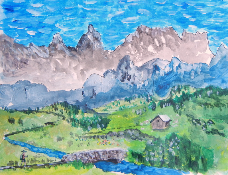
imaginary alpine scene
That could be me coming to a bridge over an idyllic mountain stream, but I just made this scene up while testing some new paints. One of those peaks could be Mont Blanc, too! In less than 2 weeks I will see for myself when I arrive in Chamonix to hike the trail known as the Tour du Mont Blanc, or TMB. Training with a pack is one thing, but trying to decide on what to bring is another. The perfect is the enemy of the good, yet I waste hours of thought and time dabbling with various paints, brushes, papers and so on, until I almost feel like forgetting about sketching altogether! However, that would be dumb, because I know that when I get there I’ll be itching to do a sketch – so around it goes. This fantasy was done on heavy watercolour paper using cheap acrylic paints that came in a set. The tubes hold 10ml each, and as soon as I squeezed some out I knew that 10ml would not be enough. For one thing the paint is too thin, and doesn’t cover anywhere nearly as well as high quality paint does. Regular size tubes hold 60ml, which is way too much, but there aren’t any good paints sold in smaller tubes. Winsor Newton makes sets of 20ml tubes however, so I may try those. No doubt it’s decent paint. On any hiking trip you one should keep the gear down to a minimum, thus my sweating over the size of the paint tubes. It seems ridiculous, but ounces add up to pounds, as they say. Two more weeks to get it all sorted…

what to take?
Filed under Great Hikes, Painting, Uncategorized